Current Weather Outlook
Statewide weather outlook from Florida Division of Emergency Management Meteorology
Friday July 18, 2025
...Abundant Moisture Remains Over Far Western Florida Panhandle...Localized Flash Flooding and Ponding Water Possible...Isolated to Widely Scattered Thunderstorms Possible Over Peninsula...Triple Digit Heat Index Values Develop Statewide...Heat Advisories in Effect Across East Florida; Temperatures to Feel Like 104 to 108-degrees...High Risk of Rip Currents Continues for Florida Panhandle & Gold Coast Beaches...Tropical Cyclone Development Not Expected Next 7 Days
Updated at 10:27 AM EDT
Today's Threats:
|
No Threat |
Low Threat |
Medium Threat |
High Threat |
|
Lightning |
Tornado |
Damaging Wind/Hail |
Wildfire |
Flash Flooding |
Excessive Heat |
Fog (Overnight) |
Rip Currents |
|
Locally Statewide |
Statewide |
West Panhandle
|
North Florida Statewide |
Florida Panhandle, Gold Coast East Coast |
![]()
Weather Summary for the Next 24 Hours:
Areas of high pressure will begin building across the Sunshine State today keeping shower and thunderstorm chances isolated to widely scattered for much of the Peninsula (25-45% chance of rain). However, abundant moisture will remain entrenched over the far western Florida Panhandle where some scattered showers are already found this morning (60-75% chance of rain) and a Slight Risk (level 2 of 4) for Flash Flooding has been outlooked. Repeated rounds of showers and thunderstorms over the same locations may lead to instances of flooding and ponding of water, especially in urban and poor drainage locations. Any summertime shower and thunderstorm may produce locally heavy downpours; A few isolated strong to severe thunderstorms cannot be ruled out with frequent lightning and gusty winds.
Hot and humid conditions will persist today, with afternoon high temperatures reaching the upper 80s to middle 90s statewide. Triple digit heat index values (100 to 105-degrees) can be expected across the state. North and Central Florida can expect to see heat index values reaching 105 to 107-degrees. Heat Advisory criteria may be reached in some locations

Isolated to widely scattered showers and thunderstorms will dissipate this evening across the state, keeping rain chances low overnight (10-20% chance of rain). Low temperatures will remain in the 70s and low 80s statewide.

![]()

Tropical cyclone activity is not expected during the next 7 days in the Atlantic basin. For the latest on the tropics, please visit the National Hurricane Center (NHC) at www.hurricanes.gov.
![]()

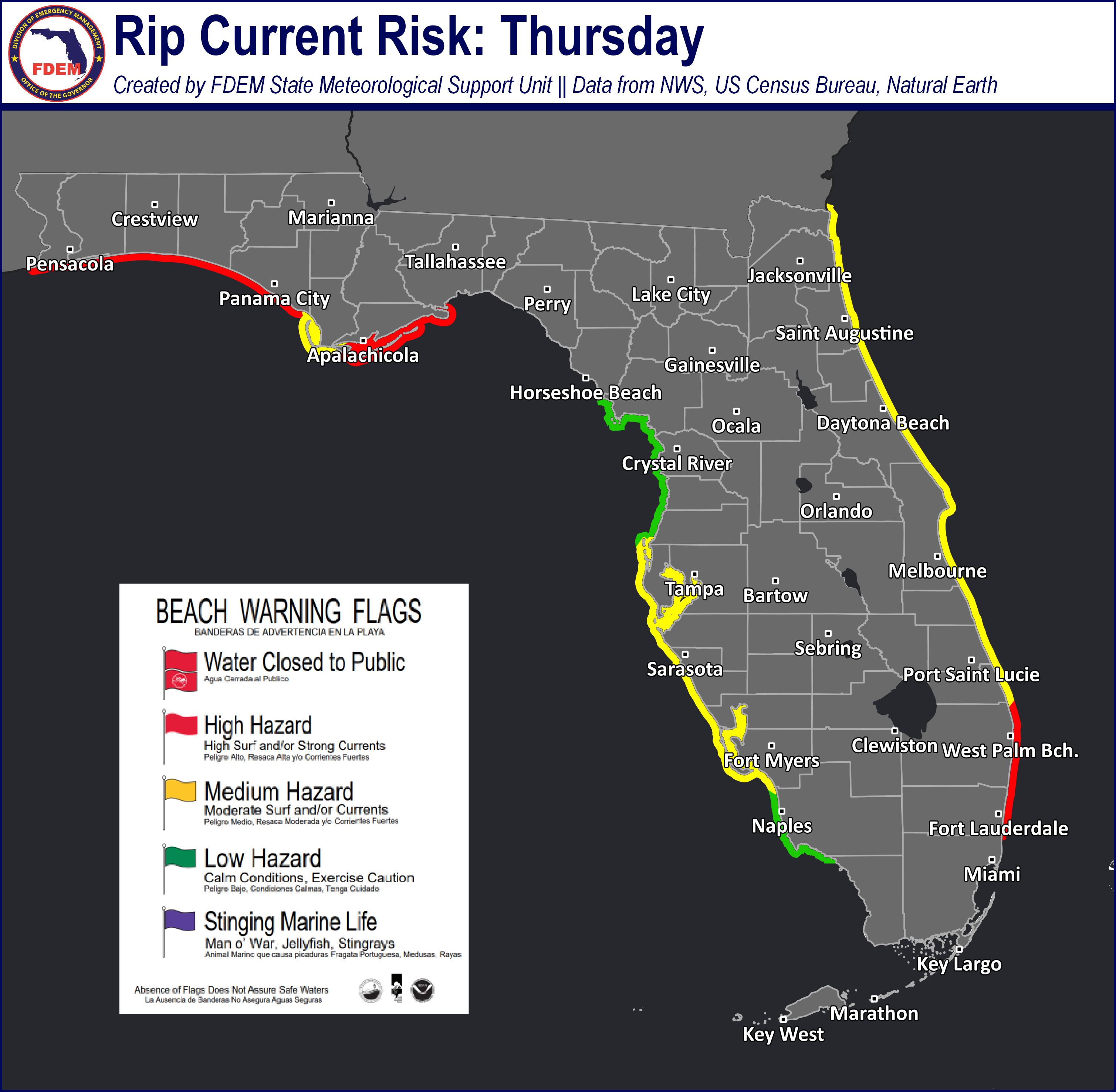
Rip Currents: There is a high risk of rip currents along most Florida Panhandle and Gold Coast beaches today and a moderate risk of rip currents along all other East Coast beaches. For the latest Rip Current Outlook, visit www.weather.gov/beach.
Marine Hazards: Wave heights of around 2-3’ can be expected along Florida Panhandle and East coast beaches today, with wave heights of 1-2’ across West coast beaches.
Red Tide has not been observed above background concentrations along any Florida coastline over the past week (valid 7/11).
Coastal Flooding: There is no risk for coastal flooding today.
![]()
Fire Weather: Shower and thunderstorm activity will be much more isolated to widely scattered today as the deep southerly flow and tropical moisture from recent days wanes. Relative humidities will remain above critical thresholds statewide (50-70% RH values), especially across the far western Panhandle where abundant moisture will stick around yielding a greater chance for shower and thunderstorm activity. Any thunderstorms that do develop will be capable of producing very frequent lightning and gusty/erratic winds which may lead to new ignitions or localized spread of existing brush fires. Elevated rain chances and improving soil/vegetation saturation will keep the overall wildfire threat low. According to the Florida Forest Service, there are 22 active wildfires across the state burning approximately 15,154 acres.

Drought: Improvements continue to be made along the Treasure Coast with the recent active weather pattern that brought plentiful rainfall last week of 1-3”. Severe drought (level 2 of 4) and Moderate drought (level 1 of 4) were nearly removed completely within this region. The Nature Coast and portions of central Marion County remain in Moderate drought (level 1 of 4) where longer term drought conditions and lower streamflow persists, however recent heavy rainfall may lead to further improvements and be reflected in next weeks drought update. Conditions largely remain unchanged along the I-95 corridor, with Severe drought (level 2 of 4) persisting across Southeast Florida. Central Palm Beach County was removed from Extreme drought conditions (level 3 of 4), though western Miami-Dade county has been upgraded to this drought level.
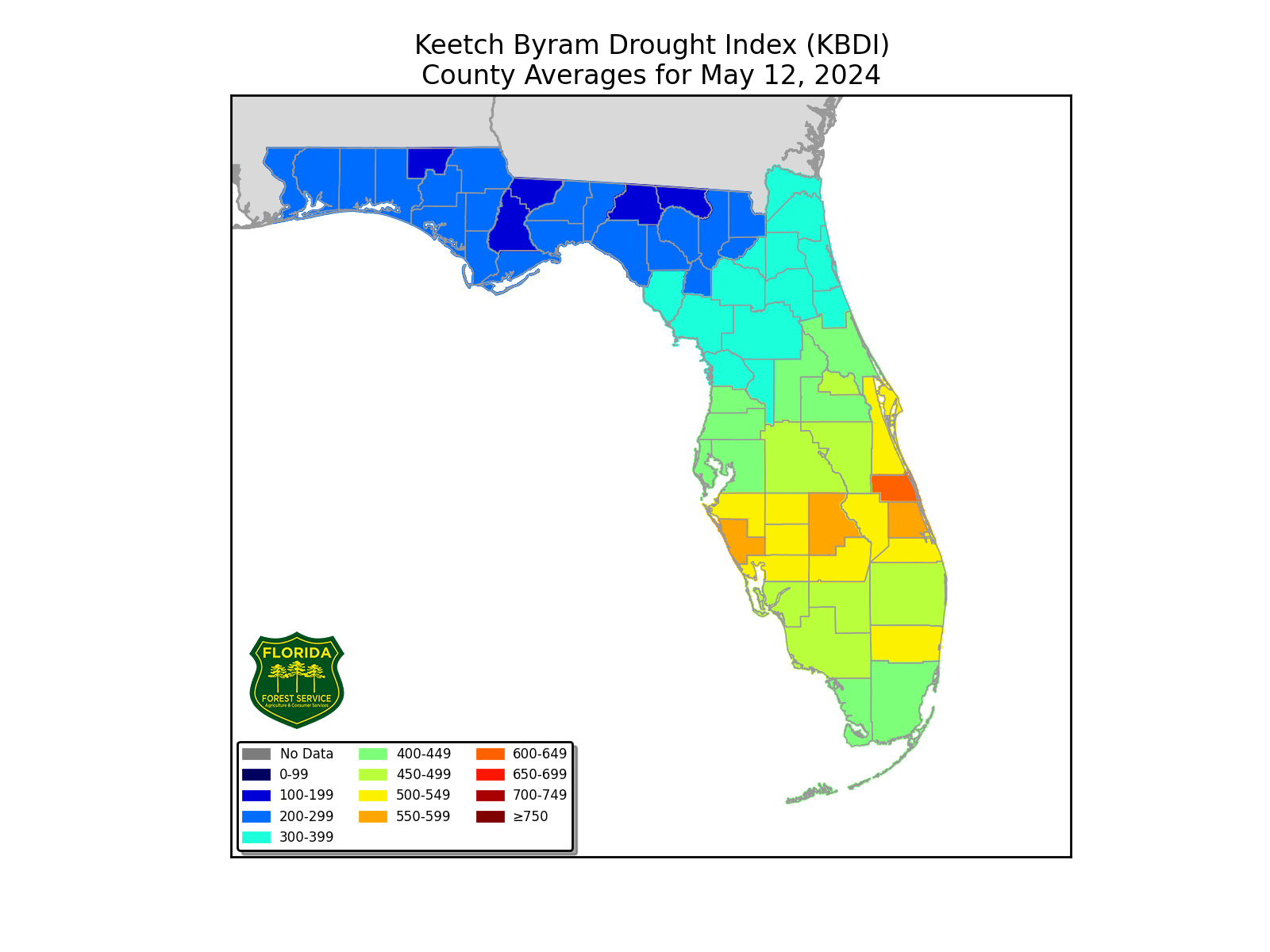
The Keetch-Byram Drought Index average for Florida is 146 (-2) on a scale from 0 (very wet) to 800 (very dry). Zero Florida counties have an average KBDI over 500 (drought/increased fire danger).
![]()
Flash Flooding: Abundant moisture will stick around over the far western Florida Panhandle today where a Slight Risk (level 2 of 4) for Flash Flooding remains outlooked for Okaloosa County on west, and a Marginal Risk (level 1 of 4) extending eastward to the US-231 corridor. Recent daily thunderstorm activity may lead to an earlier onset to flash flooding and ponding of water this afternoon across the western Panhandle, especially for urban and low-lying/poor drainage areas. Localized areas may see 1-2” of rain where any repeated rounds of showers and embedded thunderstorms occur; isolated higher amounts upwards of 3” are possible for any repeated rounds of intense downpours. Any isolated shower and thunderstorm across the Peninsula will have the chance to produce localized flooding, especially in urban and poor drainage areas.

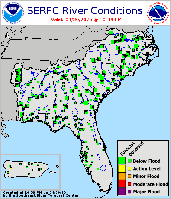
Riverine Flooding: The Ocklawaha River at Rodman Dam was observed at Minor Flood Stage this morning, with upstream gauges at Moss Bluff Dam, Ocala, and Eureka observed at Action Stage (Bank-full). Fisheating Creek at Palmdale remains at Action Stage (bank-full) this morning as well. No widespread significant riverine responses are expected; however, conditions will be heavily dependent upon where any prolonged thunderstorm activity occurs resulting in possible localized elevated riverine gauge levels. Additional updates to these forecasts will be likely through the week. For more information, visit the River Forecast Center.
Lake Okeechobee’s average elevation is 11.85 feet, which is within the operational band and is 1.77 feet below normal for this time of year.